Great cities
start with great data
Turn real data into decisions. See your city clearly across every layer, and convert raw data into answers — for systematic, evidence-based urban strategy.

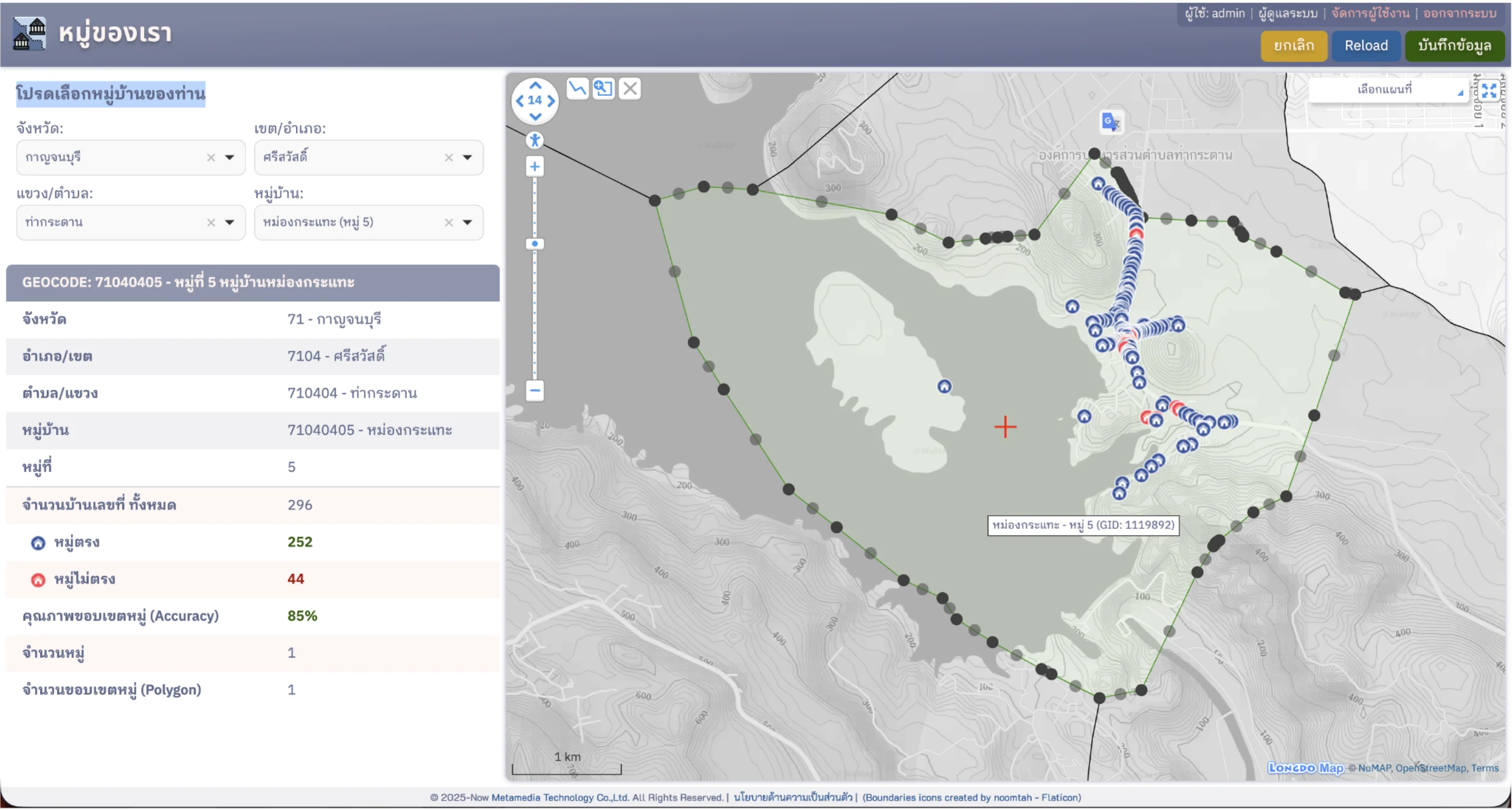
Join "Our Village" and use
CDP free for 1 year
Help build the village-boundary dataset for your area so CDP gets sharper and more accurate — and unlock a full year of the platform, free.
Everything a smart city needs
Powerful tools to manage and analyze urban data effectively
GIS data hub & Digital Twin
A central hub for the city's geospatial data — digital maps, hi-res imagery, building models and related layers.
Citizen platform (CityFlow)
One front door for complaints, requests and permits — linking citizens to internal agency workflows efficiently.
Accident intelligence
Surface the highest-risk accident spots for targeted fixes — aiming for zero road deaths.
Open & extensible
Built from open-standard components, so it's easy to extend and build on in the future.
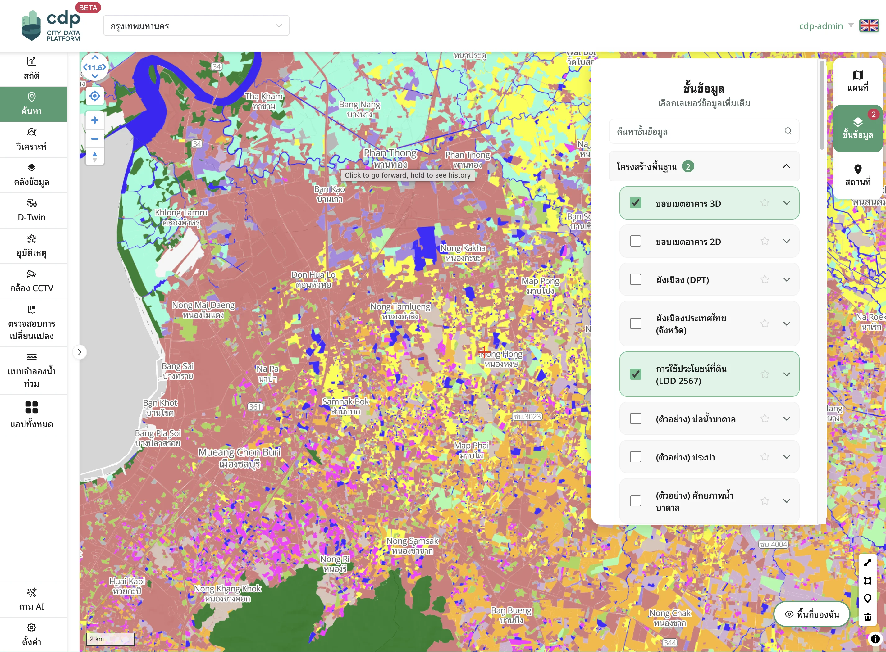
Geospatial data hub
A single home for all map and geospatial data — easy for every department to connect to and republish to citizen-facing sites. No more data scattered across systems, plus extra layers from Longdo Map and partners worldwide, or build your own.
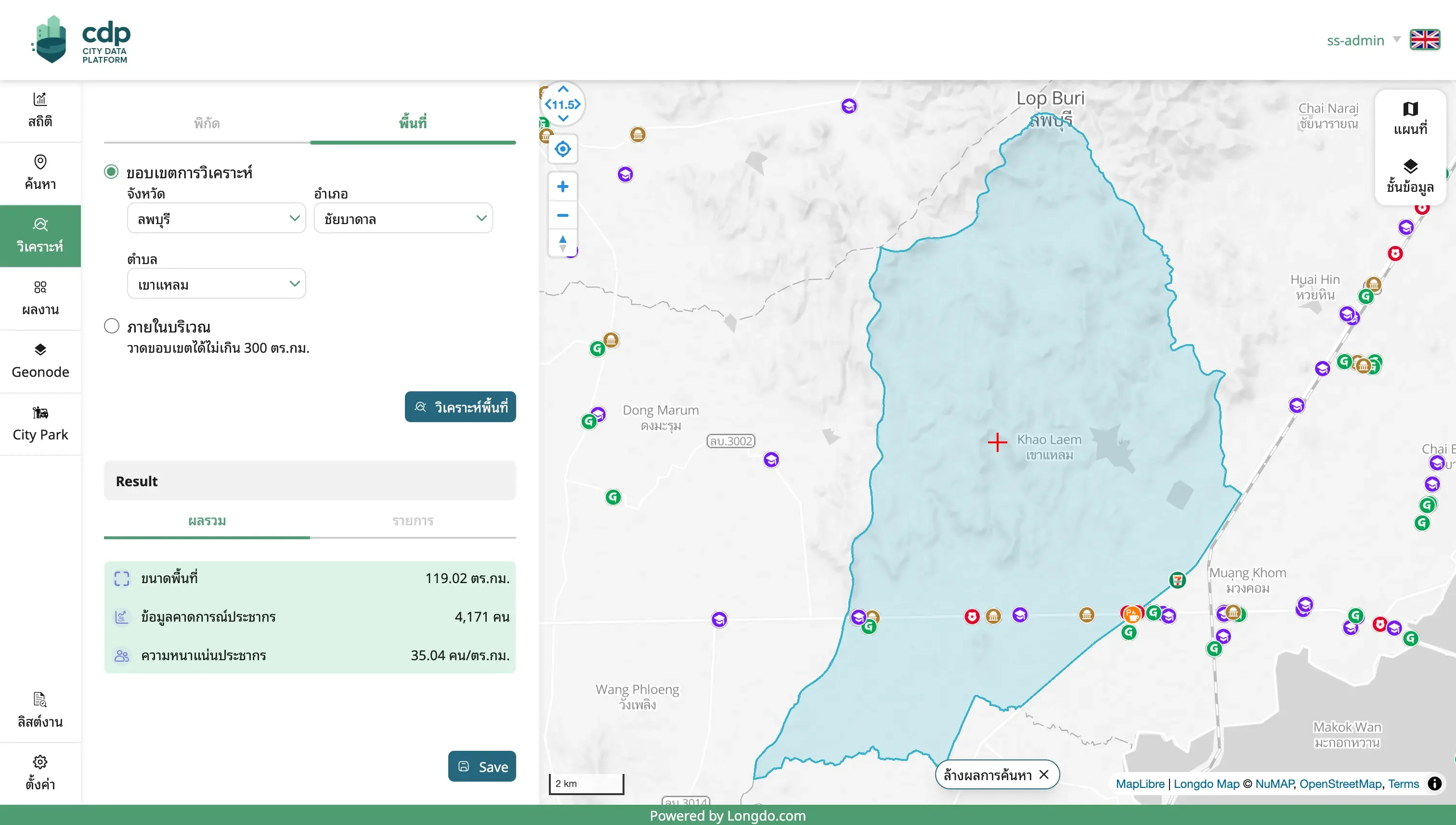
Area analysis
Profile any chosen area — fast — across many layers: population, places by category with detail, land-use summaries, recurring-flood data and much more, to judge how suitable it is for any activity.
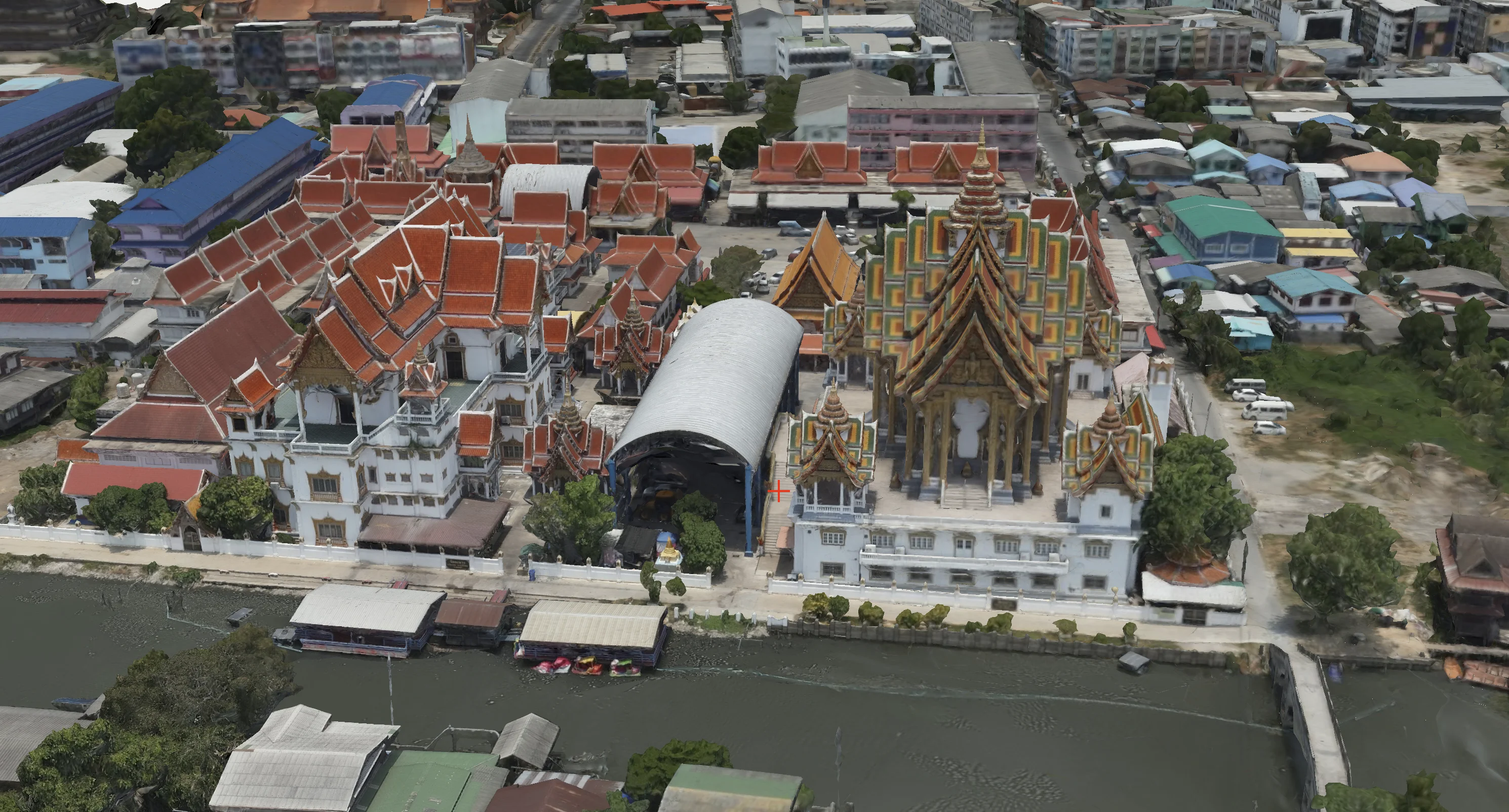
Digital Twin : GIS + Mobility
Build a digital twin of the city from physical data — hi-res maps and 3D mesh building models — fused with live feeds from sensors and vehicle positions. Simulate scenarios before doing them for real: placing new structures, or modelling traffic impact to plan ahead.
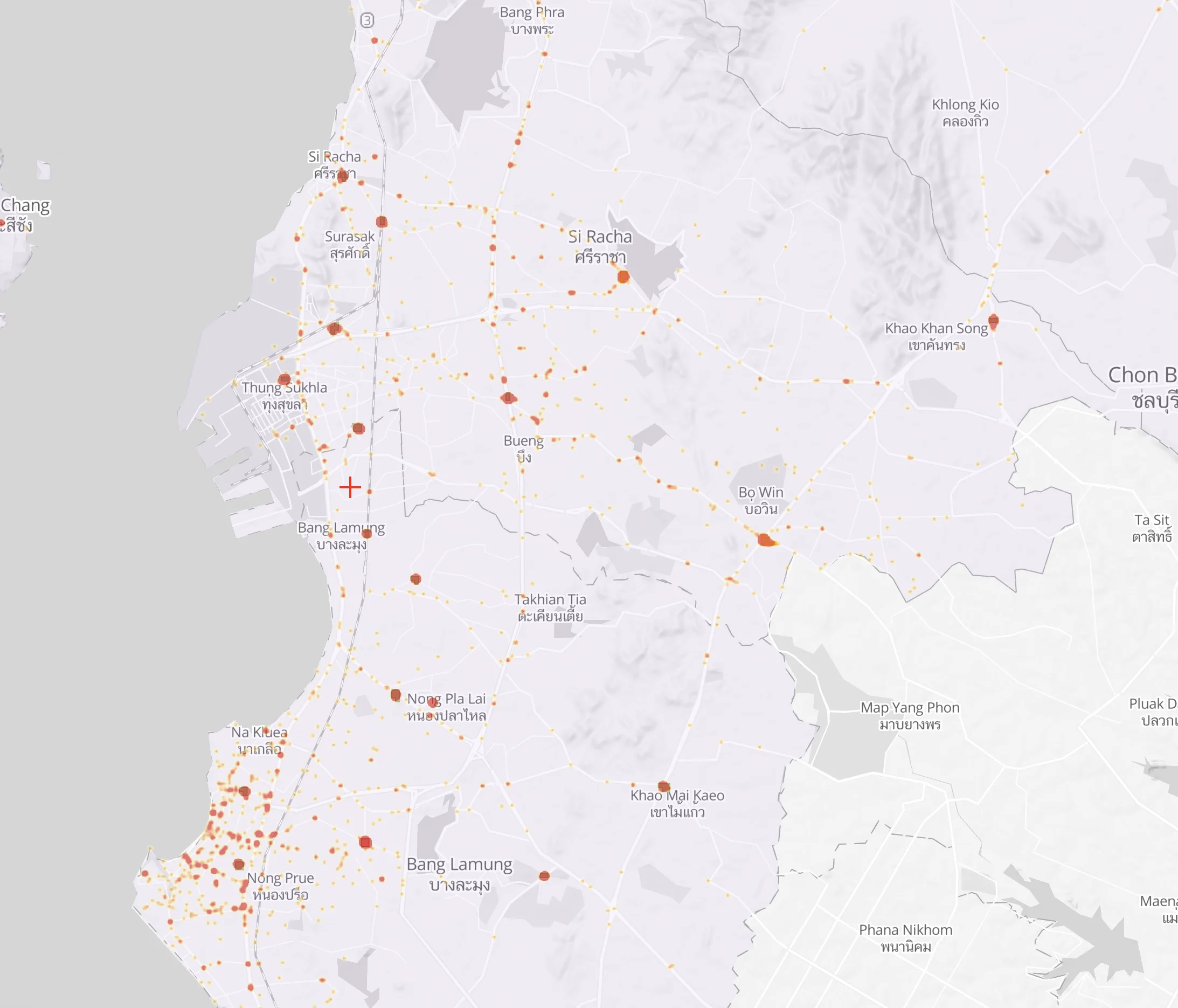
iTIC: Accident hot-spots
Analyze the TOP 200 highest-risk accident hot-spots over yearly or monthly windows — from crash locations, severity and casualty counts — for targeted fixes proven to reduce accidents.
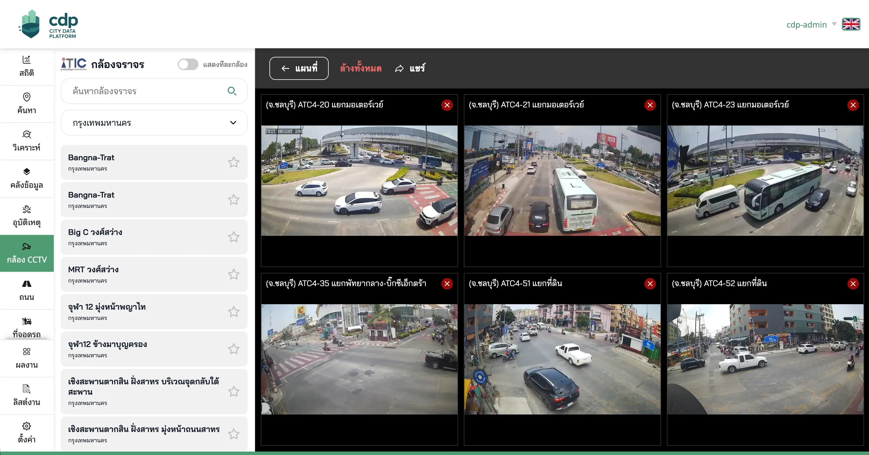
iTIC: Traffic cameras
Bring every local CCTV camera into one real-time hub that redistributes streams efficiently — saving bandwidth and network costs — so officers can watch any situation, anywhere, anytime.
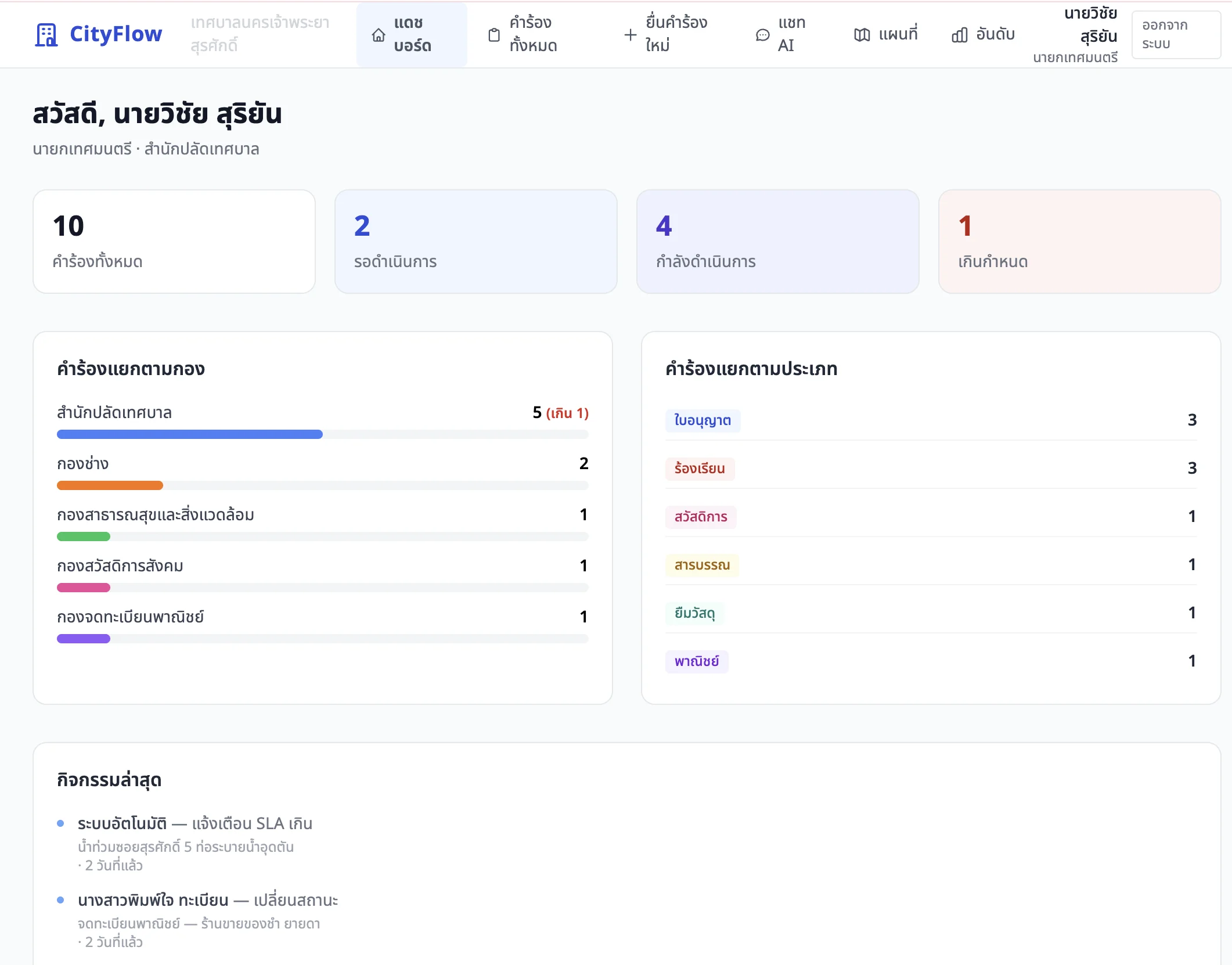
CityFlow
End-to-end city issue management. Citizens file complaints, requests and questions on one screen; cases route straight to the responsible unit and hand off cleanly. Every step is online in one database everyone sees in real time — so staff can solve problems without waiting for orders.
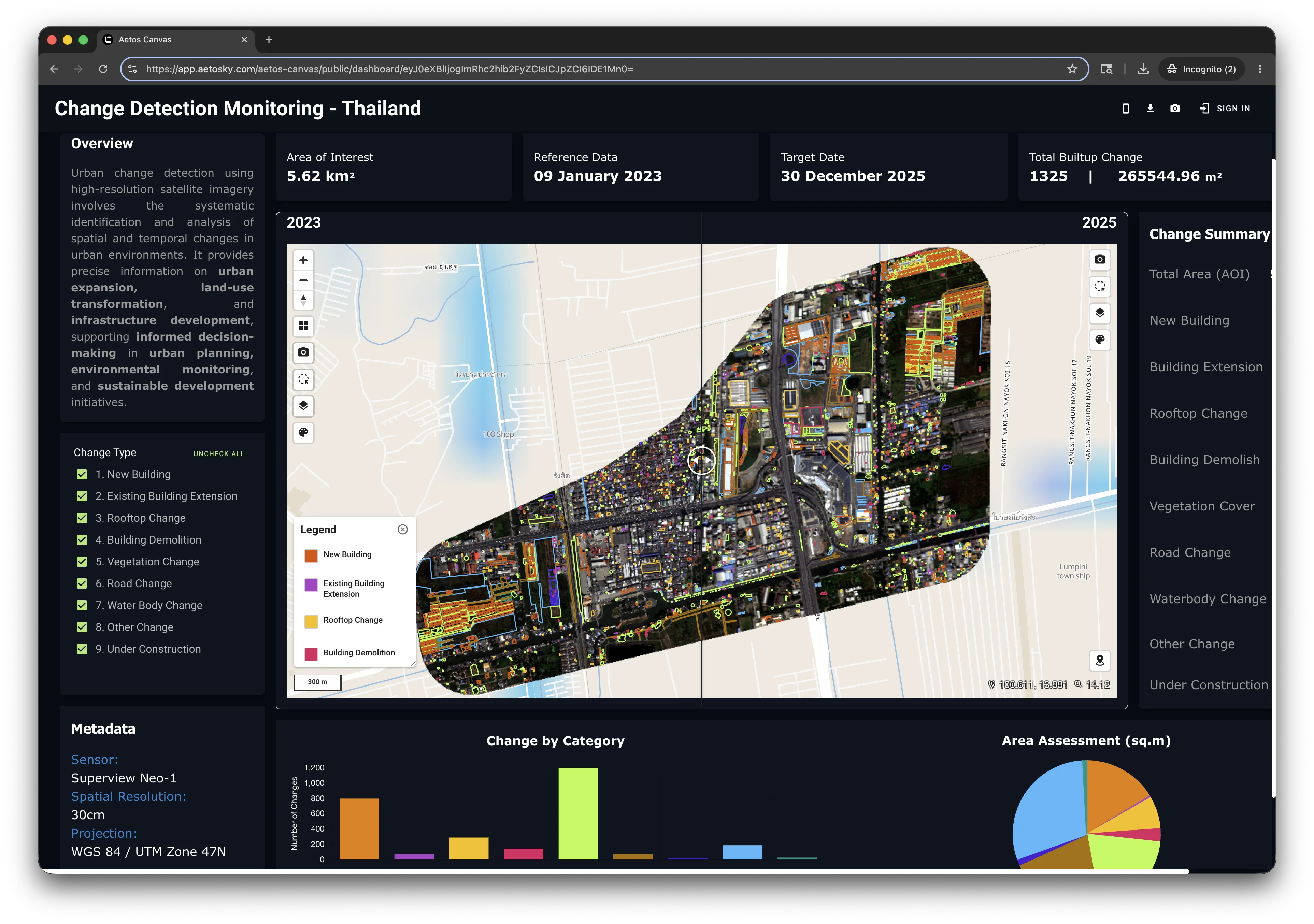
Changes Detection
Automatically detect changes on the ground from hi-res aerial imagery captured over time, fused with AI — instantly flagging new construction on once-empty land, site improvements, or land-use changes, so officers can act.
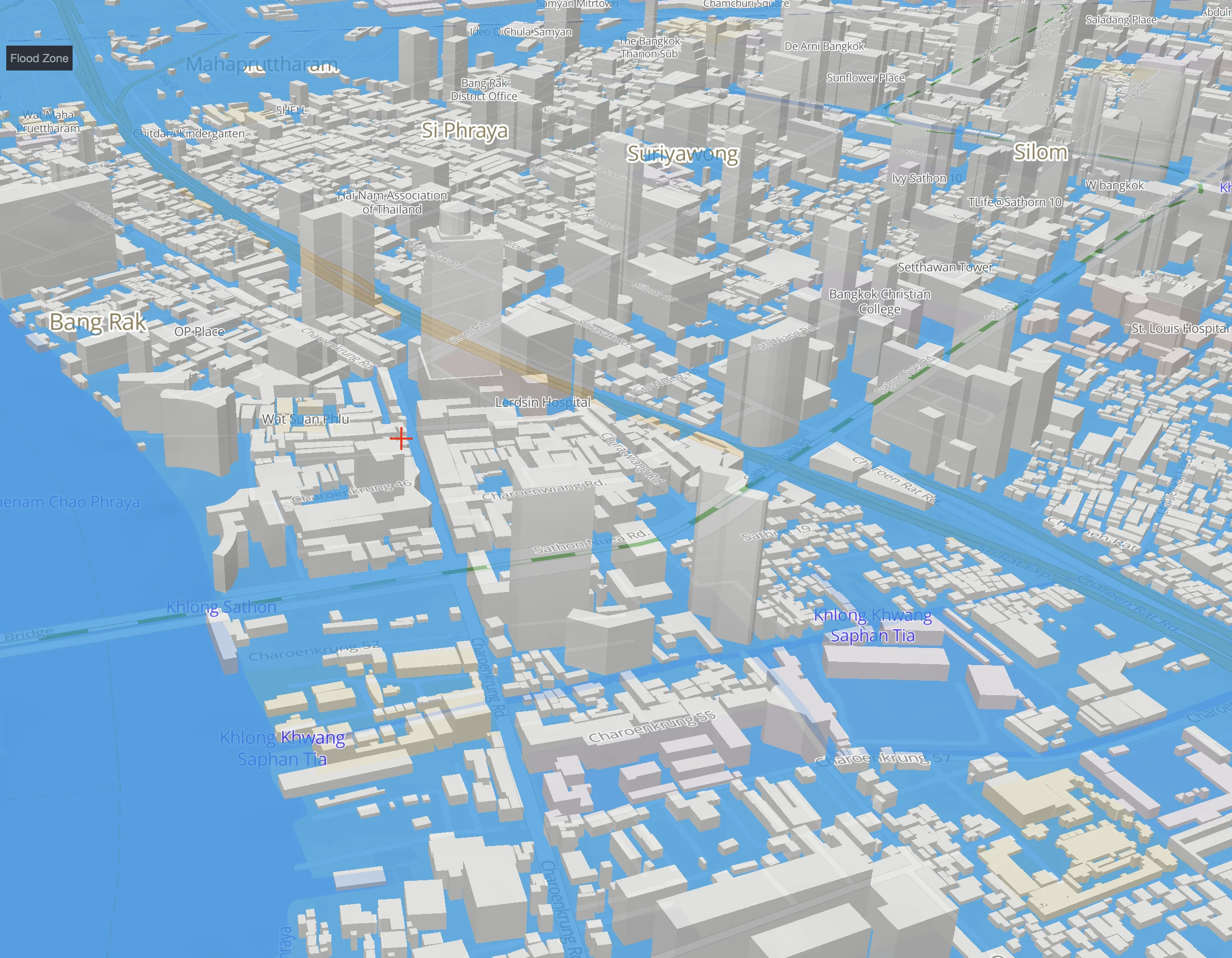
Flood simulation
Visualize flooding across an area from geospatial analysis, or set a water level by height above mean sea level — and the system shows exactly which parts of the area would be inundated.
Coming soon
New capabilities in development to take city management further
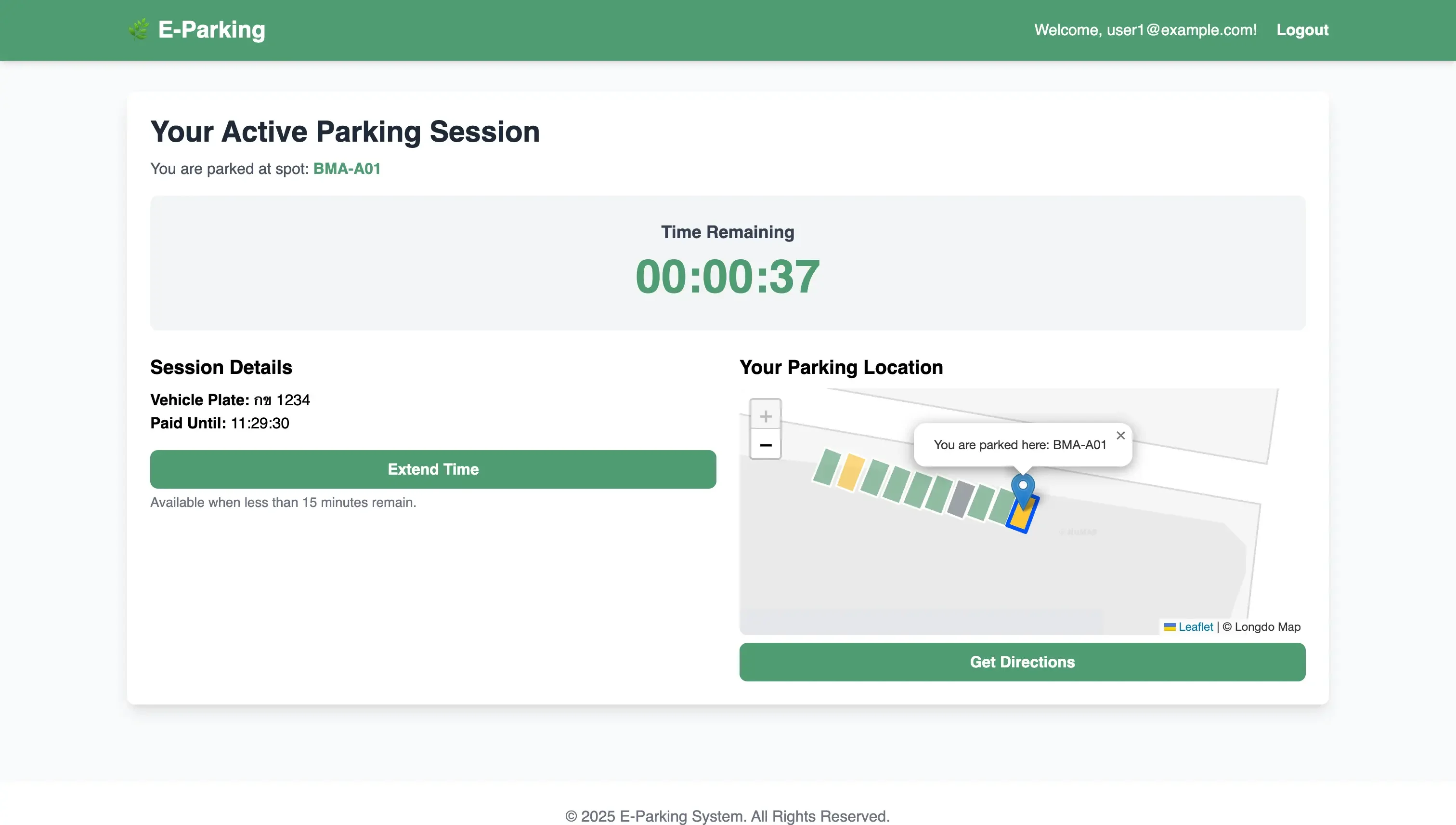
Smart parking
Efficient curbside parking with auto-detection, online payment and time-up alerts.
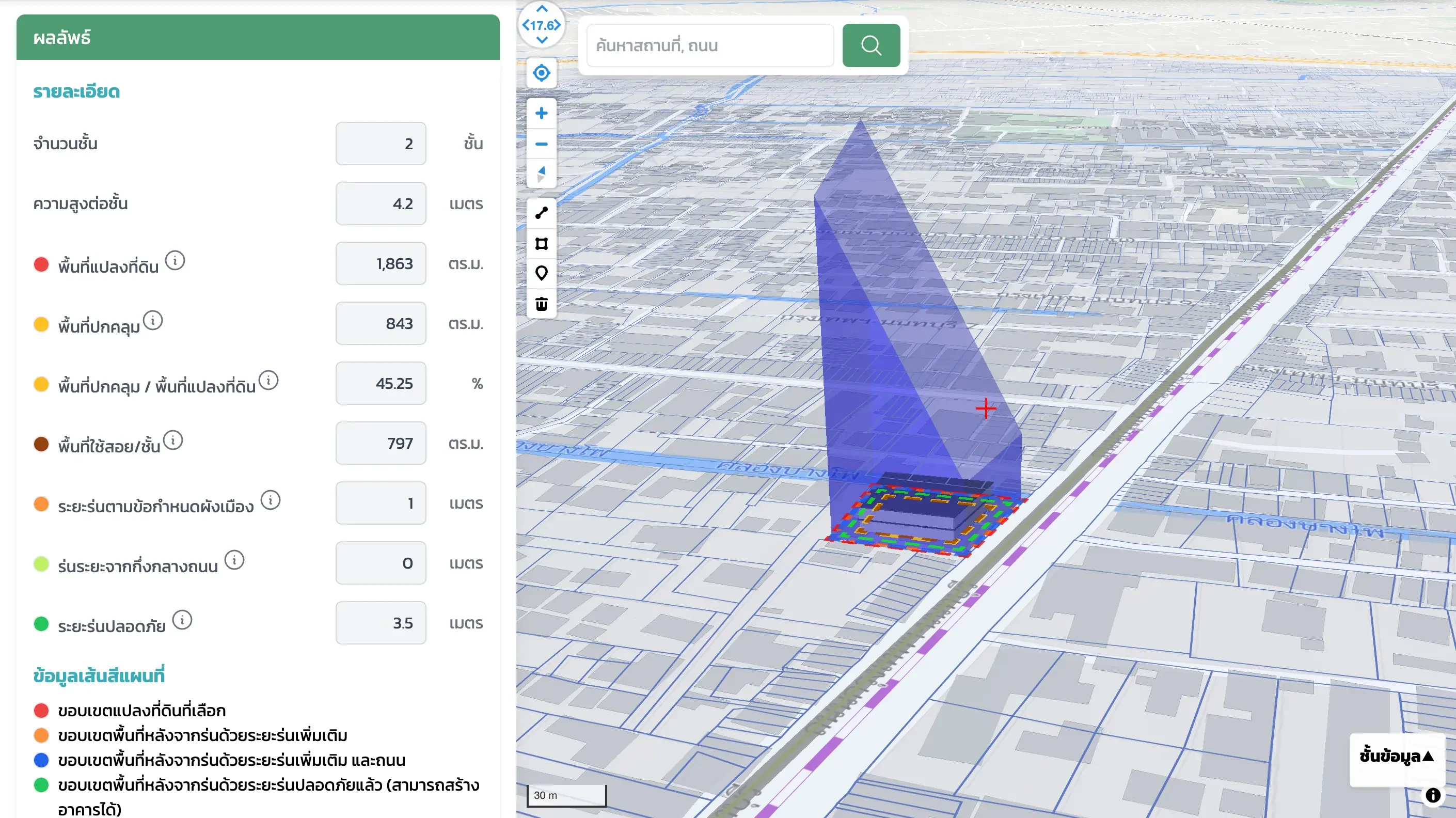
Building & zoning
Validate building feasibility on any parcel by turning complex regulations into an information system.
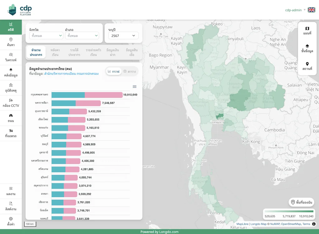
Nationwide coverage, ready today
One platform that brings every layer of city data together
Ready to build a smarter city?
We'll help you find the smart-city solution that fits your organization.
Get in touch
Tell us about your project
Fill in our short online form and our team will get back to you.
Open the contact form
Scan the QR code to fill out the online form